



Writing on its hundredth anniversary, William B. Vanneman called the storm of October 1878 the worst hurricane to strike Salem County. It took the roof off the Presbyterian Church at Salem, put two feet of water through houses at Hancocks Bridge, and left Charles Ewell of Elsinboro clinging to an uprooted tree until a boat could reach him. Our own archive gives the date two different ways, and the calendar settles most of the argument.
The date, before anything else
We are going to deal with this at the top rather than bury it, because this paper would rather be trusted than tidy.
Fond Recollections carries the storm twice, in two different chapters, and dates it differently each time.
In Chapter 7, which opens on the subject of storms, it is “the worst hurricane to strike Salem County, Wednesday Oct. 23, 1878.”
In Chapter 17, on postmasters and mail carriers, it is “the Oct. 21, 1878 tidal-wave storm.”
Both are in our archive exactly as the book prints them, and the calendar does most of the work of choosing between them. October 23, 1878 was a Wednesday, so the Chapter 7 account agrees with itself. October 21, 1878 was a Monday, and the Chapter 17 reference gives no day of the week to check it against. The longer account is also the one written specifically about the storm, by a man who had gone and collected the recollections of people who were in it.
So we are going with October 23 and saying why. The two-day gap is still worth flagging rather than quietly correcting, partly because a slip of two days in a chapter about something else is exactly how errors propagate through local history, and partly because storms of this kind do not confine themselves to one afternoon; the water that flooded the Hancock’s Bridge meadows and the wind that took the church roof need not have arrived together.
If anyone has a newspaper of that week, a diary, or a family account with a date in it, that would close it properly, and we would print the correction gladly if it goes the other way.
The storm’s damage
The account was written by William B. Vanneman and published in his Golden Days column on October 23, 1978, the storm’s hundredth anniversary. It is the fullest thing we have, and it is worth keeping in mind that when he called this the worst hurricane to strike Salem County he was measuring it against the hundred years behind him, which is as far as any of our sources can see.
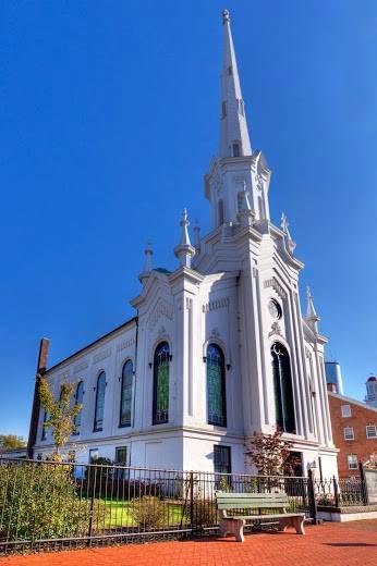
In Salem, the roof blew off the Presbyterian Church and the stained-glass windows broke.
In Lower Alloways Creek Township, buildings were blown down, cattle drowned and crops destroyed. At Hancocks Bridge the water stood two feet deep inside some houses.
Mary Hewitt of the Hancock House said her grandparents’ home in Elsinboro was destroyed and that they had to flee for their lives.
Charles Ewell of Elsinboro went out to check his meadow bank, which is what a man with meadow does when the water is rising, and found himself surrounded. He climbed an uprooted tree. Then he climbed a second one. He was taken off after four hours by men in a boat.
John Polly of Salem held onto a fence until he was pulled out. The men who got him were R. T. Starr, Thomas B. Starr, James Henzey, A. Vanderslice, Charles W. Pierpont and William Hall.
At the Dutch Fisheries in Lower Penns Neck, nine men spent the storm huddled together on a high spot, and pushed their horse into the water to make room for themselves.
That last detail is the one that stays with you. Nine men on a patch of ground, and the arithmetic of it.
The mail went through anyway…. via ferry
Fifty pages away in the same book, in a chapter about postmasters that was written for an entirely different purpose, is the only other thing the archive says about this storm, and it is the best sort of corroboration because nobody was trying to corroborate anything.
Isaac N. Davis lived at Canton and carried the mail on the Canton to Salem route, making round trips. On the day of the storm he got the mail through across the flooded Hancock’s Bridge meadows by ferry.
Davis carried the mail until July 1, 1881, when William Ayars took the route over. Ayars carried it eight years, and was succeeded on July 1, 1889 by Joseph Kline, an experienced stage driver who soon sold back to Ayars in October 1890. Ayars sold the route in April 1893 to his son-in-law William H. Davis, who from July 1, 1897 ran two trips a day on a petition from Canton, Harmersville and Hancock’s Bridge, with mail leaving Canton at 6:30 AM and 3:00 PM and Salem at 10:20 AM and 6:10 PM.
A man who ferried the mail across drowned meadows during the worst storm in the county’s history is the kind of thing that should have a plaque somewhere.
What folks then actually called it
Also in the book, from “Uncle John Fogg”: his mother Harriet, born 1853, married Albert S. Fogg in 1877, and they moved to the Bradway farm at Stow Neck that same year.
So they had been on that farm for one year when the water came. The book’s phrase is that they “lived through the 1878 Tidal Wave there.”
Notice that phrase. The family called it the Tidal Wave, not the hurricane, and so does the postmaster chapter. Around the Delaware Bay shore of this county, the thing people remembered was not the wind. It was the water coming up where water does not come.
Storms since
Vanneman’s column puts the 1878 storm at the head of a list, and the rest of the list is useful for anyone measuring one against another.
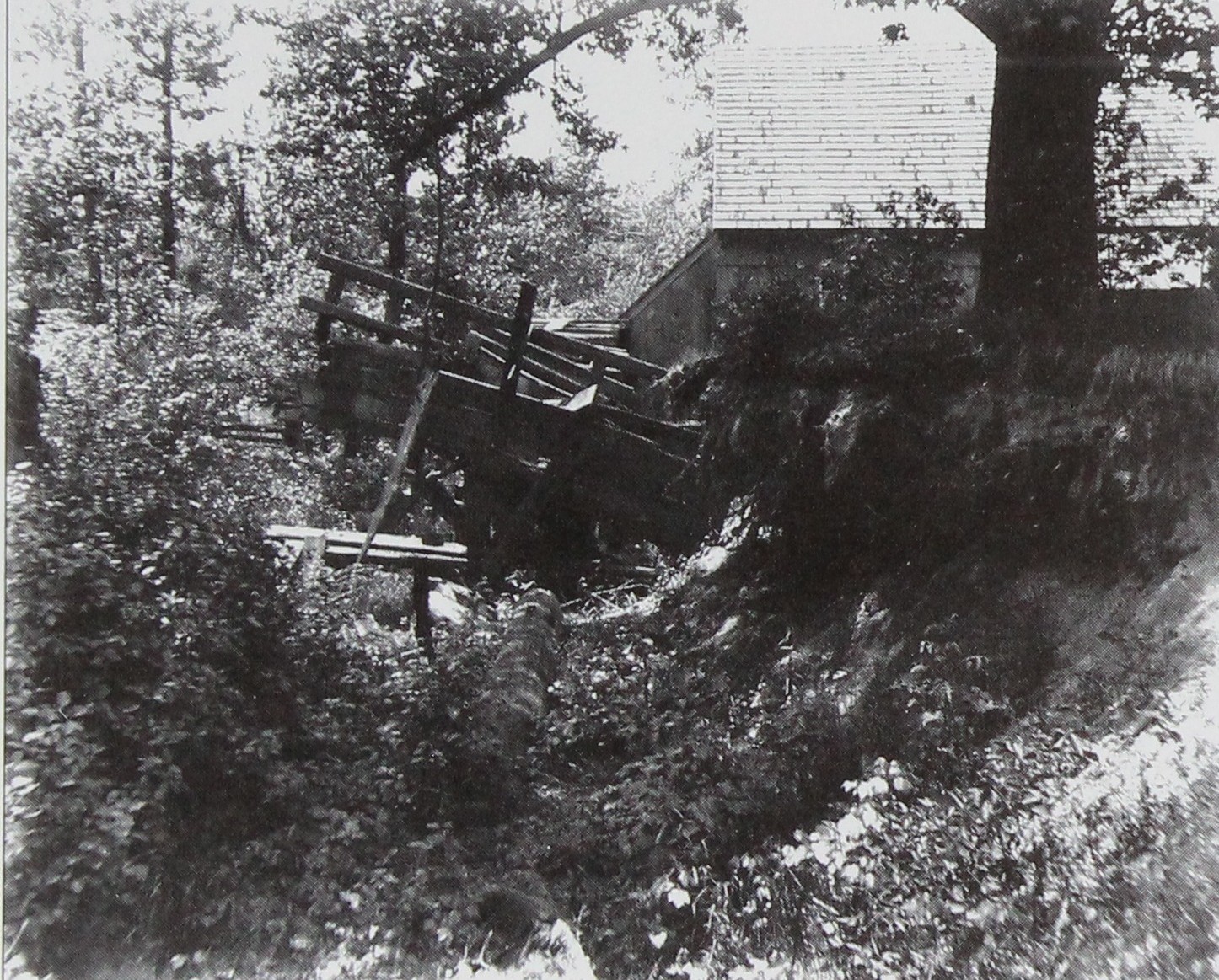
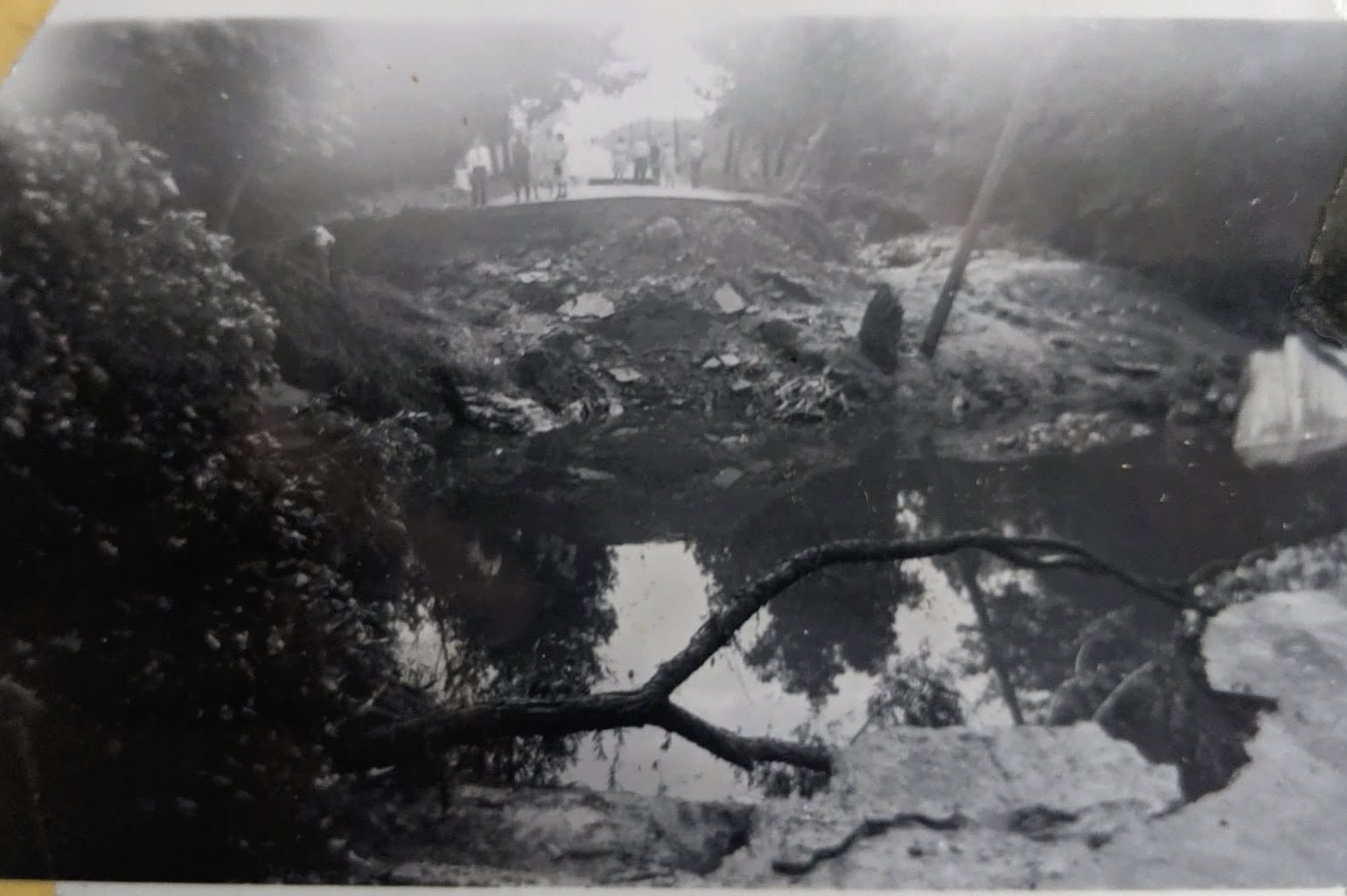
He recalls Hurricane Hazel in 1954, and a hurricane in 1933 that ruined a nearly-ready tomato crop at the Canton machine shed. The Labor Day storm of September 1940 destroyed the waste gates at Maskell’s Mill (pictured above), which were not replaced until a concrete spillway went in in 1954. The flood of September 1, 1940 took out three dams above Alloway between one and two in the morning, carried away the railroad trestle at Deep Run, ended the rail connection between Alloway and Quinton, and killed Mrs. Zora Crispin and her eighteen-month-old daughter Hazel Emma Crispin.
Against that list, 1878 is still the one the books call the worst.
The forty-eight years since
Vanneman’s list stops where he stopped writing, in 1978, and a good deal of water has come up this shore since. What follows does not come from the books. It comes from the National Weather Service, the Office of the New Jersey State Climatologist and the state’s own emergency declarations, and it is set down here so that anyone holding 1878 up against a storm they remember has the figures to do it with.
One thing to understand first. The National Weather Service’s tidal flooding reference for Salem County does not read a gauge in Salem County at all. It reads the water at Reedy Point, Delaware, at the eastern end of the Chesapeake and Delaware Canal, across and a little down the bay. That ranked list of high tides is the nearest thing this shore has to a scoreboard.
Hurricane Isabel, September 19, 2003, put the Reedy Point gauge at 8.7 feet.
Sandy, October 29 and 30, 2012. Sandy came ashore just south of Atlantic City at eight o’clock on the Monday evening. The southeasterly flow behind it drove water up Delaware Bay and produced record water levels in the tidal Delaware River; the Reedy Point gauge reached 9.1 feet on the thirtieth.
And here is the part that catches people out. Sandy does not sit at the top of that list. Two other dates sit above it, April 16, 2011 and December 21, 2012, the second of them only seven weeks after Sandy itself and remembered by almost nobody. October 25, 1980 is close behind Sandy as well. The water takes no notice of whether we gave the storm a name, and the ones this county talks about are not always the ones that pushed the most water.
The remnants of Hurricane Ida, September 1, 2021. The tornado that day was an EF-3 with winds near 150 miles an hour, tracking from Harrisonville through Mullica Hill to Deptford, and it stayed on the Gloucester County side of the line. The state climatologist’s figures give Salem County a maximum of 1.98 inches of rain, at Woodstown, and no tornado. The county got off lightly.
But look again at the date. The flood that took out the three dams above Alloway came on September 1, 1940. Ida’s remnants crossed New Jersey on September 1, 2021, eighty-one years to the day.
October 29, 2021. The Delaware River came over its banks at Penns Grove and Carneys Point late on a Friday night. Downstairs units at the Penn Village Apartments on South Smith Avenue flooded and residents were moved out, and responders evacuated the Carney’s Point Care Center. That was nine years to the day after Sandy made landfall.
Against all of that, 1878 is still the one the books call the worst. It is worth saying plainly that this cannot be checked. Nobody alive saw both, the gauges that would settle it were not installed for another century, and Vanneman was ranking the storm against the hundred years behind him with no way to see the forty-eight ahead.
What we would like to know
Can anyone produce a newspaper, a diary or a dated photograph from that week? Did the Presbyterian Church at Salem leave any record of replacing that roof and those windows? And is there a single surviving photograph of the 1878 storm anywhere in this county?
We do admit that we have not checked the historical societies nor have we combed through the old newspapers. Please, be our guest.
Sources. Fond Recollections, edited by David A. Fogg, pages 92 to 93, quoting William B. Vanneman’s Golden Days column of October 23, 1978, and pages 268 to 269, from the chapter on postmasters and mail carriers written by Wm. J. S. Bradway for the Salem Standard and Jerseyman, November 5, 1931. Later storms from Fond Recollections pages 58 to 59 and 64 to 65, and Alloway Remembers pages 263 to 266. Days of the week calculated from the calendar.